What is this Google Ads geographic location code?
I connected to my Google Ads account through Tableau's API and pulled a Geographic report. However, I am confused as to what these codes/fields mean? I've googled each field and I can't find anything that resembles the format of these numeric codes. How can I translate these locations to names of cities/areas?
Thanks
I'm guessing the Metro area is the Designated Marketing Area(DMA) or Media Market. This page has these entries in a linked CSV and states to contact Nielson for DMA data.
https://developers.google.com/adwords/api/docs/appendix/geotargeting
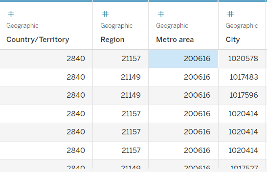
"1020578","Riverside","Riverside,Missouri,United States","21157","US","City",Active "1017483","Gardner","Gardner,Kansas,United States","21149","US","City",Active "1017596","Overland Park","Overland Park,Kansas,United States","21149","US","City",Active
Also see https://en.wikipedia.org/wiki/Media_market.